
Thala topographic map
Interactive map
Click on the map to display elevation.
About this map
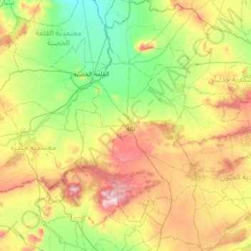
Name: Thala topographic map, elevation, terrain.
Location: Thala, Kasserine, 1231, Tunisie (35.36246 8.55372 35.79092 8.83962)
Average elevation: 2,828 ft
Minimum elevation: 1,886 ft
Maximum elevation: 4,593 ft
Other topographic maps
Click on a map to view its topography, its elevation and its terrain.
El Khadhra
El Khadhra, Kasserine Nord, Kasserine, Tunisie
Average elevation: 2,224 ft