
Thank you for supporting this site ❤️
Make a donation
Make a donation
Gear up for your next adventure:
As an Amazon Associate, this site earns from qualifying purchases at no extra cost to you.
Tychy topographic map
Click on the map to display elevation.
Thank you for supporting this site ❤️
Make a donation
Make a donation
Gear up for your next adventure:
As an Amazon Associate, this site earns from qualifying purchases at no extra cost to you.
About this map
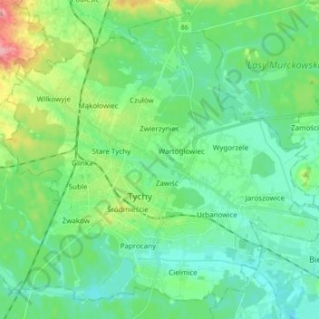
Name: Tychy topographic map, elevation, terrain.
Location: Tychy, Metropolis GZM, Silesian Voivodeship, Poland (50.07717 18.92527 50.17583 19.09152)
Average elevation: 840 ft
Minimum elevation: 755 ft
Maximum elevation: 1,096 ft
Thank you for supporting this site ❤️
Make a donation
Make a donation
Gear up for your next adventure:
As an Amazon Associate, this site earns from qualifying purchases at no extra cost to you.