
Thank you for supporting this site ❤️
Make a donation
Make a donation
Gear up for your next adventure:
As an Amazon Associate, this site earns from qualifying purchases at no extra cost to you.
Charilla topographic map
Click on the map to display elevation.
Thank you for supporting this site ❤️
Make a donation
Make a donation
Gear up for your next adventure:
As an Amazon Associate, this site earns from qualifying purchases at no extra cost to you.
About this map
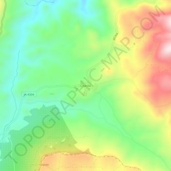
Name: Charilla topographic map, elevation, terrain.
Location: Charilla, Alcalá la Real, Jaén, Andalucía, 23692, España (37.47580 -3.92870 37.51580 -3.88870)
Average elevation: 3,022 ft
Minimum elevation: 2,425 ft
Maximum elevation: 3,934 ft
Thank you for supporting this site ❤️
Make a donation
Make a donation
Gear up for your next adventure:
As an Amazon Associate, this site earns from qualifying purchases at no extra cost to you.