Geolocate

Grayson Valley topographic map

Click on the map to display elevation.

About this map

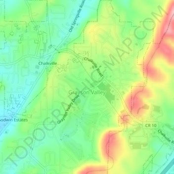
Name: Grayson Valley topographic map, elevation, terrain.

Location: Grayson Valley, Jefferson County, Alabama, United States (33.63416 -86.66221 33.66390 -86.62671)

Average elevation: 971 ft

Minimum elevation: 794 ft

Maximum elevation: 1,250 ft

Jefferson County trails, hiking, mountain biking, running and outdoor activities

Gear up for your next adventure:

📡GPS Antenna Upgrade - Enhance GPS reception in remote terrain
Backpacking Tent - Lightweight and durable tent for multi‑day hikes
🔊Portable Camp Speaker - Music and alerts at camp
Solar GPS Watches - Advanced multisport watches with built-in topographic maps
🏕️Tent Footprint - Protect your tent base from wear

As an Amazon Associate, this site earns from qualifying purchases at no extra cost to you.