
Thank you for supporting this site ❤️
Make a donation
Make a donation
Gear up for your next adventure:
As an Amazon Associate, this site earns from qualifying purchases at no extra cost to you.
Kuriwa topographic map
Click on the map to display elevation.
Thank you for supporting this site ❤️
Make a donation
Make a donation
Gear up for your next adventure:
As an Amazon Associate, this site earns from qualifying purchases at no extra cost to you.
About this map
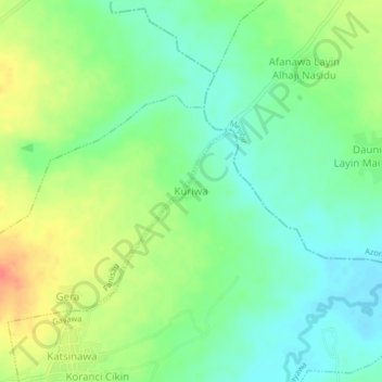
Name: Kuriwa topographic map, elevation, terrain.
Location: Kuriwa, Gayawa, Ungongo, Kano State, Nigeria (12.08280 8.54594 12.12280 8.58594)
Average elevation: 1,473 ft
Minimum elevation: 1,407 ft
Maximum elevation: 1,572 ft
Thank you for supporting this site ❤️
Make a donation
Make a donation
Gear up for your next adventure:
As an Amazon Associate, this site earns from qualifying purchases at no extra cost to you.