
Thank you for supporting this site ❤️
Make a donation
Make a donation
Gear up for your next adventure:
As an Amazon Associate, this site earns from qualifying purchases at no extra cost to you.
Ananuri topographic map
Click on the map to display elevation.
Thank you for supporting this site ❤️
Make a donation
Make a donation
Gear up for your next adventure:
As an Amazon Associate, this site earns from qualifying purchases at no extra cost to you.
About this map
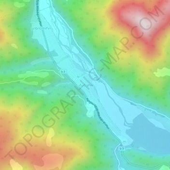
Name: Ananuri topographic map, elevation, terrain.
Location: Ananuri, Dusheti Municipality, Mtskheta-Mtianeti, Georgia (42.15703 44.67060 42.19703 44.71060)
Average elevation: 3,461 ft
Minimum elevation: 2,585 ft
Maximum elevation: 5,194 ft
Thank you for supporting this site ❤️
Make a donation
Make a donation
Gear up for your next adventure:
As an Amazon Associate, this site earns from qualifying purchases at no extra cost to you.