
沙梨园 topographic map
Interactive map
Click on the map to display elevation.
About this map
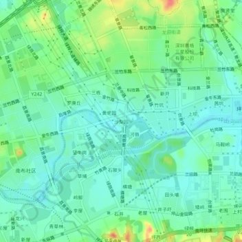
Name: 沙梨园 topographic map, elevation, terrain.
Location: 沙梨园, 龙田街道, 坪山区, 深圳市, 广东省, 518118, 中国 (22.68965 114.36033 22.72965 114.40033)
Average elevation: 135 ft
Minimum elevation: 79 ft
Maximum elevation: 272 ft
Other topographic maps
Click on a map to view its topography, its elevation and its terrain.