
坑梓街道 topographic map
Interactive map
Click on the map to display elevation.
About this map
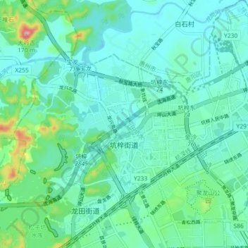
Name: 坑梓街道 topographic map, elevation, terrain.
Location: 坑梓街道, 坪山区, 深圳市, 广东省, 中国 (22.71835 114.35214 22.78392 114.41592)
Average elevation: 148 ft
Minimum elevation: 49 ft
Maximum elevation: 554 ft
Other topographic maps
Click on a map to view its topography, its elevation and its terrain.