
Thank you for supporting this site ❤️
Make a donation
Make a donation
Gear up for your next adventure:
As an Amazon Associate, this site earns from qualifying purchases at no extra cost to you.
河底村 topographic map
Click on the map to display elevation.
Thank you for supporting this site ❤️
Make a donation
Make a donation
Gear up for your next adventure:
As an Amazon Associate, this site earns from qualifying purchases at no extra cost to you.
About this map
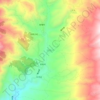
Name: 河底村 topographic map, elevation, terrain.
Location: 河底村, Xundian Hui and Yi Autonomous County, Yunnan, China (25.57275 102.89278 25.61275 102.93278)
Average elevation: 8,071 ft
Minimum elevation: 7,136 ft
Maximum elevation: 9,062 ft
Thank you for supporting this site ❤️
Make a donation
Make a donation
Gear up for your next adventure:
As an Amazon Associate, this site earns from qualifying purchases at no extra cost to you.