Geolocate

Hullbridge topographic map

Click on the map to display elevation.

About this map

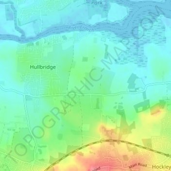
Name: Hullbridge topographic map, elevation, terrain.

Location: Hullbridge, Rochford, Essex, England, United Kingdom (51.60122 0.60432 51.63726 0.66595)

Average elevation: 66 ft

Minimum elevation: -16 ft

Maximum elevation: 259 ft

Gear up for your next adventure:

📡GPS Antenna Upgrade - Enhance GPS reception in remote terrain
🪄Magnetic Compass - Accurate compass for navigation
🎁Geography Themed Gifts - Unique gift ideas for map lovers and geography enthusiasts
🛰️Satellite Messengers - Emergency SOS and two-way messaging for off-grid adventures
🎒Trail Energy Bars - High‑calorie bars for hiking energy

As an Amazon Associate, this site earns from qualifying purchases at no extra cost to you.