
Thank you for supporting this site ❤️
Make a donation
Make a donation
Gear up for your next adventure:
As an Amazon Associate, this site earns from qualifying purchases at no extra cost to you.
Penwortham topographic map
Click on the map to display elevation.
Thank you for supporting this site ❤️
Make a donation
Make a donation
Gear up for your next adventure:
As an Amazon Associate, this site earns from qualifying purchases at no extra cost to you.
About this map
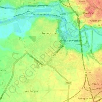
Name: Penwortham topographic map, elevation, terrain.
Location: Penwortham, South Ribble, Lancashire, England, United Kingdom (53.72524 -2.77452 53.75763 -2.69306)
Average elevation: 75 ft
Minimum elevation: 3 ft
Maximum elevation: 157 ft
Thank you for supporting this site ❤️
Make a donation
Make a donation
Gear up for your next adventure:
As an Amazon Associate, this site earns from qualifying purchases at no extra cost to you.