
Thank you for supporting this site ❤️
Make a donation
Make a donation
Gear up for your next adventure:
As an Amazon Associate, this site earns from qualifying purchases at no extra cost to you.
Karkonosze topographic map
Click on the map to display elevation.
Thank you for supporting this site ❤️
Make a donation
Make a donation
Gear up for your next adventure:
As an Amazon Associate, this site earns from qualifying purchases at no extra cost to you.
About this map
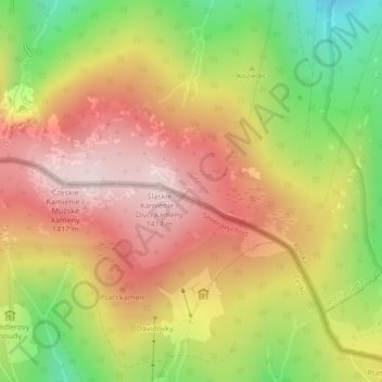
Name: Karkonosze topographic map, elevation, terrain.
Location: Karkonosze, Jelenia Góra, Lower Silesian Voivodeship, Poland (50.77640 15.60522 50.77650 15.60532)
Average elevation: 3,924 ft
Minimum elevation: 3,074 ft
Maximum elevation: 4,610 ft
Thank you for supporting this site ❤️
Make a donation
Make a donation
Gear up for your next adventure:
As an Amazon Associate, this site earns from qualifying purchases at no extra cost to you.