
Gasherbrum II topographic map
Click on the map to display elevation.
Gasherbrum II
Gasherbrum II is located on the border of Gilgit–Baltistan, Pakistan, and Xinjiang, China. It is part of the Karakoram mountain range in the Himalayas, and located at the top of the Baltoro Glacier. With an elevation of 8,034 metres (26,358 ft) it is the third-highest member of the Gasherbrum group, behind Gasherbrum I (8,080 metres or 26,510 feet) and Broad Peak (8,051 metres or 26,414 feet). Gasherbrum III is sometimes considered to be a subpeak of Gasherbrum II, because the former has a topographic prominence of only 461 metres (1,512 ft).
About this map
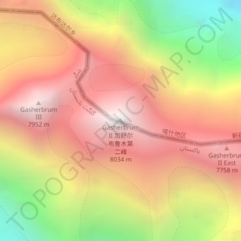
Name: Gasherbrum II topographic map, elevation, terrain.
Average elevation: 23,287 ft
Minimum elevation: 19,180 ft
Maximum elevation: 26,220 ft