Geolocate

Mount Wesley topographic map

Click on the map to display elevation.

About this map
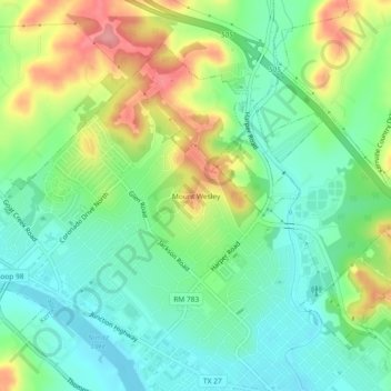
Name: Mount Wesley topographic map, elevation, terrain.

Location: Mount Wesley, Kerrville, Kerr County, Texas, 78029, United States (30.05465 -99.17949 30.09465 -99.13949)

Average elevation: 1,749 ft

Minimum elevation: 1,617 ft

Maximum elevation: 1,985 ft

Texas trails, hiking, mountain biking, running and outdoor activities

Gear up for your next adventure:

🛠️Backpacking Tool Kit - Essential toolkit for outdoor repairs
📷Action Camera - Capture your outdoor adventures in HD
🎒Trail Energy Bars - High‑calorie bars for hiking energy
🔌Solar Panel Charger - Charge gear sustainably outdoors
🔭Stargazing Telescopes - Perfect for camping in low-light pollution areas shown on maps

As an Amazon Associate, this site earns from qualifying purchases at no extra cost to you.