Geolocate

Hothfield topographic map

Click on the map to display elevation.

About this map

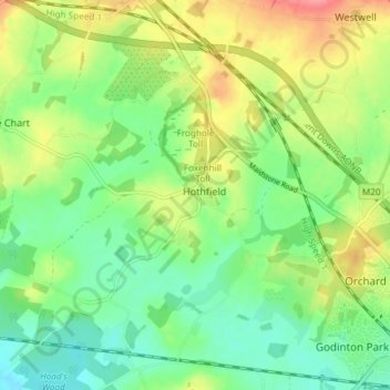
Name: Hothfield topographic map, elevation, terrain.

Location: Hothfield, Ashford, Kent, England, United Kingdom (51.14914 0.77336 51.19269 0.84736)

Average elevation: 200 ft

Minimum elevation: 105 ft

Maximum elevation: 348 ft

Gear up for your next adventure:

🚗GPS Dash Cams - Record your scenic drives through mountain passes and canyons
🪶Compact Camp Shovel - Folding shovel for campsite tasks
🪶Camp Gear Gift Set - Perfect gift bundle for outdoor fans
📶Satellite Messenger - Communication device off‑grid
🌄Hiking Binoculars - Compact binoculars for scenic views and trail spotting

As an Amazon Associate, this site earns from qualifying purchases at no extra cost to you.