
Thank you for supporting this site ❤️
Make a donation
Make a donation
Gear up for your next adventure:
As an Amazon Associate, this site earns from qualifying purchases at no extra cost to you.
妻籠宿 topographic map
Click on the map to display elevation.
Thank you for supporting this site ❤️
Make a donation
Make a donation
Gear up for your next adventure:
As an Amazon Associate, this site earns from qualifying purchases at no extra cost to you.
About this map
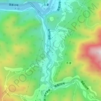
Name: 妻籠宿 topographic map, elevation, terrain.
Location: 妻籠宿, 妻籠, 南木曽町, 木曽郡, Préfecture de Nagano, 3995301, Japon (35.56647 137.58493 35.58647 137.60493)
Average elevation: 1,818 ft
Minimum elevation: 1,188 ft
Maximum elevation: 3,018 ft
Thank you for supporting this site ❤️
Make a donation
Make a donation
Gear up for your next adventure:
As an Amazon Associate, this site earns from qualifying purchases at no extra cost to you.