Geolocate

Meyers Lake topographic map

Interactive map

Click on the map to display elevation.

About this map

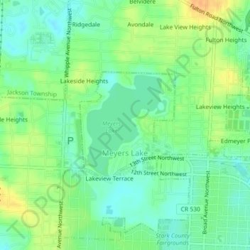
Name: Meyers Lake topographic map, elevation, terrain.

Location: Meyers Lake, Stark County, Ohio, United States (40.80973 -81.42297 40.82132 -81.40931)

Average elevation: 1,125 ft

Minimum elevation: 1,079 ft

Maximum elevation: 1,191 ft

Stark County trails, hiking, mountain biking, running and outdoor activities

Other topographic maps

Click on a map to view its topography, its elevation and its terrain.

Lake Cable

United States > Ohio > Stark County

Average elevation: 1,115 ft

Mount Vernon

United States > Ohio > Stark County > Canton

Average elevation: 1,129 ft

New England

United States > Ohio > Stark County > Massillon

Average elevation: 1,043 ft

Myers

United States > Ohio > Stark County

Average elevation: 1,142 ft

Maple Leaf Lake

United States > Ohio > Stark County

Average elevation: 1,161 ft

Mount Union

United States > Ohio > Stark County > Alliance > Mount Union

Average elevation: 1,191 ft