
Mont Amba topographic map
Interactive map
Click on the map to display elevation.
About this map
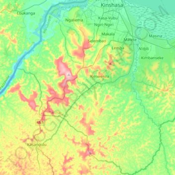
Name: Mont Amba topographic map, elevation, terrain.
Location: Mont Amba, Kongo Central, Democratic Republic of the Congo (-4.64889 15.12944 -4.31290 15.40837)
Average elevation: 1,178 ft
Minimum elevation: 778 ft
Maximum elevation: 2,103 ft
Other topographic maps
Click on a map to view its topography, its elevation and its terrain.
Matadi
Democratic Republic of the Congo > Kongo Central
Matadi, Kongo Central, Democratic Republic of the Congo
Average elevation: 719 ft