Geolocate

Kovalam topographic map

Click on the map to display elevation.

About this map

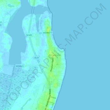
Name: Kovalam topographic map, elevation, terrain.

Location: Kovalam, Tiruporur, Chengalpattu, Tamil Nadu, 603112, India (12.76774 80.23093 12.80774 80.27093)

Average elevation: 3 ft

Minimum elevation: -7 ft

Maximum elevation: 39 ft

Gear up for your next adventure:

🗻Climbing Gear Basics - Essential gear for beginner climbers
🛰️Satellite Messengers - Emergency SOS and two-way messaging for off-grid adventures
🎒Trekking Poles - Sturdy poles for balance and stability on rough terrain
GPS Sports Watch - GPS watch for running, hiking and training
🌐World Map Poster - Decorative world maps with topographic info

As an Amazon Associate, this site earns from qualifying purchases at no extra cost to you.