
Thank you for supporting this site ❤️
Make a donation
Make a donation
Gear up for your next adventure:
As an Amazon Associate, this site earns from qualifying purchases at no extra cost to you.
Nanga topographic map
Click on the map to display elevation.
Thank you for supporting this site ❤️
Make a donation
Make a donation
Gear up for your next adventure:
As an Amazon Associate, this site earns from qualifying purchases at no extra cost to you.
About this map
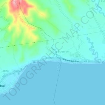
Name: Nanga topographic map, elevation, terrain.
Location: Nanga, Guimbal, Iloilo, Western Visayas, 5021, Philippines (10.65420 122.32395 10.69420 122.36395)
Average elevation: 79 ft
Minimum elevation: 0 ft
Maximum elevation: 512 ft
Thank you for supporting this site ❤️
Make a donation
Make a donation
Gear up for your next adventure:
As an Amazon Associate, this site earns from qualifying purchases at no extra cost to you.