
Thank you for supporting this site ❤️
Make a donation
Make a donation
Gear up for your next adventure:
As an Amazon Associate, this site earns from qualifying purchases at no extra cost to you.
Fangazio topographic map
Click on the map to display elevation.
Thank you for supporting this site ❤️
Make a donation
Make a donation
Gear up for your next adventure:
As an Amazon Associate, this site earns from qualifying purchases at no extra cost to you.
About this map
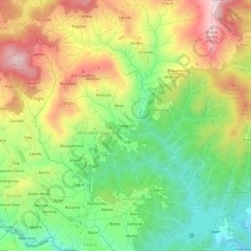
Name: Fangazio topographic map, elevation, terrain.
Location: Fangazio, Mezzana Mortigliengo, Biella, Piemonte, 13823, Italia (45.60769 8.17469 45.64769 8.21469)
Average elevation: 1,506 ft
Minimum elevation: 935 ft
Maximum elevation: 2,201 ft
Thank you for supporting this site ❤️
Make a donation
Make a donation
Gear up for your next adventure:
As an Amazon Associate, this site earns from qualifying purchases at no extra cost to you.