
Donja Pušća topographic map
Interactive map
Click on the map to display elevation.
About this map
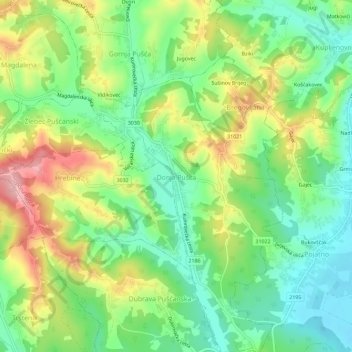
Name: Donja Pušća topographic map, elevation, terrain.
Location: Donja Pušća, Općina Pušća, Zagreb County, 10294, Croatia (45.89302 15.75924 45.93302 15.79924)
Average elevation: 614 ft
Minimum elevation: 407 ft
Maximum elevation: 938 ft