Geolocate

Freeport topographic map

Click on the map to display elevation.

About this map

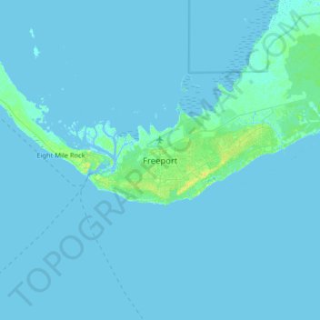
Name: Freeport topographic map, elevation, terrain.

Location: Freeport, The Bahamas (26.37568 -78.85536 26.69568 -78.53536)

Average elevation: 3 ft

Minimum elevation: -10 ft

Maximum elevation: 52 ft

Gear up for your next adventure:

🔦LED Headlamp - Bright and durable LED headlamp for night navigation
📡GPS Antenna Upgrade - Enhance GPS reception in remote terrain
🔭Stargazing Telescopes - Perfect for camping in low-light pollution areas shown on maps
🔊Portable Camp Speaker - Music and alerts at camp
🖼️Topo Map Wall Art - Decorative topographic prints of famous peaks and regions

As an Amazon Associate, this site earns from qualifying purchases at no extra cost to you.