
Witten topographic map
Click on the map to display elevation.
About this map
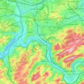
Name: Witten topographic map, elevation, terrain.
Location: Witten, Ennepe-Ruhr-Kreis, North Rhine-Westphalia, Germany (51.37007 7.24607 51.48434 7.42348)
Average elevation: 449 ft
Minimum elevation: 223 ft
Maximum elevation: 896 ft
Other topographic maps
Click on a map to view its topography, its elevation and its terrain.
Breckerfeld
Germany > North Rhine-Westphalia > Ennepe-Ruhr-Kreis > Breckerfeld > Breckerfeld
Average elevation: 1,122 ft