
Thank you for supporting this site ❤️
Make a donation
Make a donation
Gear up for your next adventure:
As an Amazon Associate, this site earns from qualifying purchases at no extra cost to you.
Tamda topographic map
Click on the map to display elevation.
Thank you for supporting this site ❤️
Make a donation
Make a donation
Gear up for your next adventure:
As an Amazon Associate, this site earns from qualifying purchases at no extra cost to you.
About this map
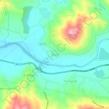
Name: Tamda topographic map, elevation, terrain.
Location: Tamda, Freha, Daïra Azazga, Tizi Ouzou, 15341, Algérie (36.68734 4.17561 36.72734 4.21561)
Average elevation: 456 ft
Minimum elevation: 253 ft
Maximum elevation: 951 ft
Thank you for supporting this site ❤️
Make a donation
Make a donation
Gear up for your next adventure:
As an Amazon Associate, this site earns from qualifying purchases at no extra cost to you.