Geolocate

Xuanhan topographic map

Click on the map to display elevation.

About this map

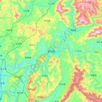
Name: Xuanhan topographic map, elevation, terrain.

Location: Xuanhan, Xuanhan County, Dazhou, Sichuan, China (31.20123 107.54918 31.52123 107.86918)

Average elevation: 1,811 ft

Minimum elevation: 876 ft

Maximum elevation: 4,049 ft

Gear up for your next adventure:

🗺️Topographic Maps - Detailed topo maps for hiking, exploring and outdoor navigation
🌎3D Topographic Globes - Raised relief globes for a tactile understanding of geography
🛡️Insect Repellent - Protection against bugs during outdoor activities
📶Vehicle Signal Boosters - Improve reception in rural areas while driving to trailheads
🥄Camping Utensil Set - Lightweight utensils for outdoor meals

As an Amazon Associate, this site earns from qualifying purchases at no extra cost to you.