
Thank you for supporting this site ❤️
Make a donation
Make a donation
Gear up for your next adventure:
As an Amazon Associate, this site earns from qualifying purchases at no extra cost to you.
Moriones topographic map
Click on the map to display elevation.
Thank you for supporting this site ❤️
Make a donation
Make a donation
Gear up for your next adventure:
As an Amazon Associate, this site earns from qualifying purchases at no extra cost to you.
About this map
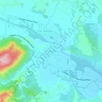
Name: Moriones topographic map, elevation, terrain.
Location: Moriones, San Jose, Tarlac, Central Luzon, 2318, Philippines (15.43344 120.44812 15.47344 120.48812)
Average elevation: 338 ft
Minimum elevation: 230 ft
Maximum elevation: 1,010 ft
Thank you for supporting this site ❤️
Make a donation
Make a donation
Gear up for your next adventure:
As an Amazon Associate, this site earns from qualifying purchases at no extra cost to you.