
Thank you for supporting this site ❤️
Make a donation
Make a donation
Gear up for your next adventure:
As an Amazon Associate, this site earns from qualifying purchases at no extra cost to you.
Sedrun topographic map
Click on the map to display elevation.
Thank you for supporting this site ❤️
Make a donation
Make a donation
Gear up for your next adventure:
As an Amazon Associate, this site earns from qualifying purchases at no extra cost to you.
About this map
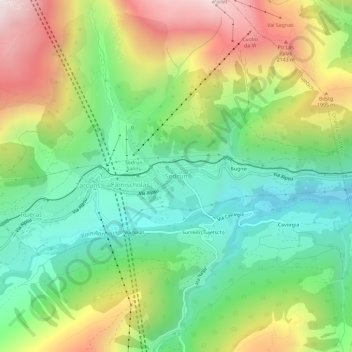
Name: Sedrun topographic map, elevation, terrain.
Location: Sedrun, Tujetsch, Surselva, Graubünden, 7188, Schweiz (46.66096 8.75622 46.70096 8.79622)
Average elevation: 5,486 ft
Minimum elevation: 4,062 ft
Maximum elevation: 7,772 ft
Thank you for supporting this site ❤️
Make a donation
Make a donation
Gear up for your next adventure:
As an Amazon Associate, this site earns from qualifying purchases at no extra cost to you.