
Petit-Lanaye topographic map
Interactive map
Click on the map to display elevation.
About this map
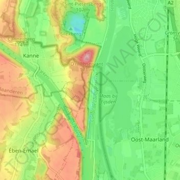
Name: Petit-Lanaye topographic map, elevation, terrain.
Location: Petit-Lanaye, Visé, Liège, Wallonie, 4600, Belgique (50.78653 5.67002 50.82653 5.71002)
Average elevation: 223 ft
Minimum elevation: 33 ft
Maximum elevation: 502 ft
Other topographic maps
Click on a map to view its topography, its elevation and its terrain.
Mons-Bombaye
Belgique > Liège > Liège > Visé
Mons-Bombaye, Visé, Liège, Wallonie, 4600, Belgique
Average elevation: 318 ft
Canal de Haccourt à Visé
Belgique > Liège > Liège > Visé
Canal de Haccourt à Visé, Visé, Liège, Wallonie, 4600, Belgique
Average elevation: 197 ft