Geolocate

Vikawe topographic map

Click on the map to display elevation.

About this map

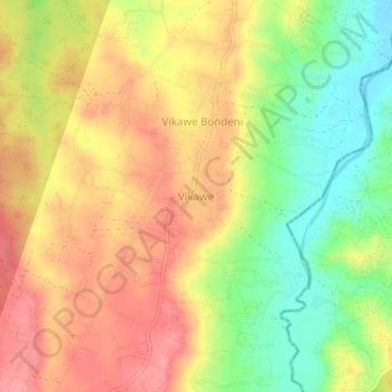
Name: Vikawe topographic map, elevation, terrain.

Location: Vikawe, Kibaha Town, Pwani Region, Coastal Zone, Tanzania (-6.68303 39.03072 -6.64303 39.07072)

Average elevation: 302 ft

Minimum elevation: 135 ft

Maximum elevation: 436 ft

Other topographic maps

Click on a map to view its topography, its elevation and its terrain.

Mkuranga

Tanzania > Pwani Region

Average elevation: 292 ft

Kisarawe

Tanzania > Pwani Region

Average elevation: 443 ft

Mkuranga

Tanzania > Pwani Region

Average elevation: 292 ft

Rufiji

Tanzania > Pwani Region

Average elevation: 180 ft

Rufiji

Tanzania > Pwani Region

Average elevation: 577 ft

Mkuranga

Tanzania > Pwani Region

Average elevation: 292 ft

ruvu river

Tanzania > Pwani Region

Average elevation: 338 ft

Mafia Island

Tanzania > Pwani Region

Average elevation: 13 ft

Rufiji

Tanzania > Pwani Region

Average elevation: 577 ft

Gear up for your next adventure:

🚗GPS Dash Cams - Record your scenic drives through mountain passes and canyons
🔌Solar Panel Charger - Charge gear sustainably outdoors
📶Vehicle Signal Boosters - Improve reception in rural areas while driving to trailheads
🛡️Bear Spray Outdoor - Protection in bear country hikes
📡Handheld GPS Device - Reliable handheld GPS for outdoor navigation

As an Amazon Associate, this site earns from qualifying purchases at no extra cost to you.