Geolocate

Masi topographic map

Click on the map to display elevation.

About this map

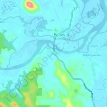
Name: Masi topographic map, elevation, terrain.

Location: Masi, Pamplona, Cagayan, Cagayan Valley, Philippines (18.43694 121.31743 18.47694 121.35743)

Average elevation: 46 ft

Minimum elevation: -13 ft

Maximum elevation: 344 ft

Gear up for your next adventure:

📱Heavy-Duty Phone Cases - Drop-proof and waterproof protection for outdoor navigation
🧢Sun Protection Hats - Wide-brimmed and UPF-rated hats for high-altitude sun safety
🥤Water Filter Bottle - All‑in‑one filter bottle for safe hydration
📶Vehicle Signal Boosters - Improve reception in rural areas while driving to trailheads
🌄Hiking Binoculars - Compact binoculars for scenic views and trail spotting

As an Amazon Associate, this site earns from qualifying purchases at no extra cost to you.