Geolocate

Fairplay topographic map

Click on the map to display elevation.

About this map

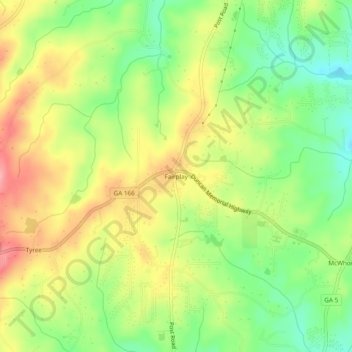
Name: Fairplay topographic map, elevation, terrain.

Location: Fairplay, Douglas County, Georgia, United States (33.60344 -84.87994 33.64344 -84.83994)

Average elevation: 1,083 ft

Minimum elevation: 906 ft

Maximum elevation: 1,280 ft

Douglas County trails, hiking, mountain biking, running and outdoor activities

Gear up for your next adventure:

📦Gear Storage Bags - Organize and protect outdoor equipment
Solar GPS Watches - Advanced multisport watches with built-in topographic maps
🧺Microfiber Travel Towels - Compact and fast-drying towels for trail use
👖Convertible Hiking Pants - Versatile zip-off pants for changing altitudes and temperatures
🔭Stargazing Telescopes - Perfect for camping in low-light pollution areas shown on maps

As an Amazon Associate, this site earns from qualifying purchases at no extra cost to you.