Geolocate

Gridley topographic map

Click on the map to display elevation.

About this map

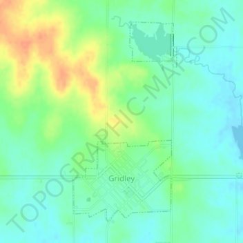
Name: Gridley topographic map, elevation, terrain.

Location: Gridley, Coffey County, Kansas, United States (38.09296 -95.89044 38.11517 -95.86667)

Average elevation: 1,148 ft

Minimum elevation: 1,102 ft

Maximum elevation: 1,230 ft

Coffey County trails, hiking, mountain biking, running and outdoor activities

Gear up for your next adventure:

🥇GPS Hiking Watch - Multi‑sport GPS watch with navigation and trail tracking
🥤Water Filter Bottle - All‑in‑one filter bottle for safe hydration
🧭Orienteering Set - Complete compass and map reading kit
🔥Fast-Boil Camping Stoves - Efficient cooking systems for quick trail meals
🧤Hiking Gloves - Protective gloves for rugged trails

As an Amazon Associate, this site earns from qualifying purchases at no extra cost to you.