
Dhodra topographic map
Click on the map to display elevation.
About this map
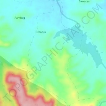
Name: Dhodra topographic map, elevation, terrain.
Location: Dhodra, Dharni, Amravati, Maharashtra, India (21.40341 76.88876 21.43527 76.90687)
Average elevation: 1,325 ft
Minimum elevation: 1,181 ft
Maximum elevation: 1,696 ft