Geolocate

Pullman topographic map

Click on the map to display elevation.

About this map

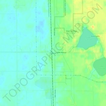
Name: Pullman topographic map, elevation, terrain.

Location: Pullman, Lee Township, Allegan County, Michigan, 49450, United States (42.46364 -86.11142 42.50364 -86.07142)

Average elevation: 653 ft

Minimum elevation: 623 ft

Maximum elevation: 705 ft

Allegan County trails, hiking, mountain biking, running and outdoor activities

Other topographic maps

Click on a map to view its topography, its elevation and its terrain.

Watson

United States > Michigan > Allegan County

Average elevation: 794 ft

Indian Lake

United States > Michigan > Allegan County

Average elevation: 817 ft

Dorr Township

United States > Michigan > Allegan County

Average elevation: 735 ft

Martin

United States > Michigan > Allegan County

Average elevation: 830 ft

Wayland

United States > Michigan > Allegan County

Average elevation: 764 ft

Fennville

United States > Michigan > Allegan County

Average elevation: 669 ft

Otsego

United States > Michigan > Allegan County

Average elevation: 728 ft

Hopkins

United States > Michigan > Allegan County

Average elevation: 709 ft

Miner Lake

United States > Michigan > Allegan County

Average elevation: 728 ft

Salem Township

United States > Michigan > Allegan County

Average elevation: 686 ft

Gear up for your next adventure:

Solar GPS Watches - Advanced multisport watches with built-in topographic maps
🪶Survival Guide Book - Expert advice for emergency preparedness
⛑️Personal Locator Beacon - Safety beacon for emergencies
🎁Geography Themed Gifts - Unique gift ideas for map lovers and geography enthusiasts
🚗GPS Dash Cams - Record your scenic drives through mountain passes and canyons

As an Amazon Associate, this site earns from qualifying purchases at no extra cost to you.