
Earl topographic map
Click on the map to display elevation.
About this map
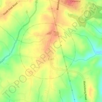
Name: Earl topographic map, elevation, terrain.
Location: Earl, Cleveland County, North Carolina, United States (35.18822 -81.54331 35.20297 -81.52533)
Average elevation: 791 ft
Minimum elevation: 679 ft
Maximum elevation: 883 ft
Cleveland County trails, hiking, mountain biking, running and outdoor activities
Other topographic maps
Click on a map to view its topography, its elevation and its terrain.
Osborne Apartments
United States > North Carolina > Cleveland County > Shelby
Average elevation: 840 ft