
Thank you for supporting this site ❤️
Make a donation
Make a donation
Gear up for your next adventure:
As an Amazon Associate, this site earns from qualifying purchases at no extra cost to you.
Nefta topographic map
Click on the map to display elevation.
Thank you for supporting this site ❤️
Make a donation
Make a donation
Gear up for your next adventure:
As an Amazon Associate, this site earns from qualifying purchases at no extra cost to you.
About this map
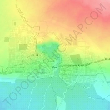
Name: Nefta topographic map, elevation, terrain.
Location: Nefta, السني, معتمدية نفطة, Tozeur, 2240, Tunisia (33.86631 7.85855 33.88500 7.89856)
Average elevation: 246 ft
Minimum elevation: 79 ft
Maximum elevation: 446 ft
Thank you for supporting this site ❤️
Make a donation
Make a donation
Gear up for your next adventure:
As an Amazon Associate, this site earns from qualifying purchases at no extra cost to you.