
Erskine topographic map
Interactive map
Click on the map to display elevation.
About this map
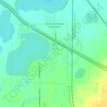
Name: Erskine topographic map, elevation, terrain.
Location: Erskine, Polk County, Minnesota, United States (47.65813 -96.02588 47.67320 -96.00349)
Average elevation: 1,198 ft
Minimum elevation: 1,171 ft
Maximum elevation: 1,250 ft
Other topographic maps
Click on a map to view its topography, its elevation and its terrain.
Lengby
United States > Minnesota > Polk County > Lengby
Lengby, Polk County, Minnesota, United States
Average elevation: 1,388 ft
Fosston
United States > Minnesota > Polk County
Fosston, Polk County, Minnesota, 56542, United States
Average elevation: 1,289 ft
Crookston
United States > Minnesota > Polk County
Crookston, Polk County, Minnesota, 56716, United States
Average elevation: 883 ft