
Lakshadweep topographic map
Interactive map
Click on the map to display elevation.
About this map
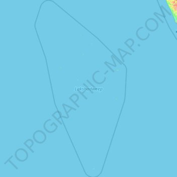
Name: Lakshadweep topographic map, elevation, terrain.
Location: Lakshadweep, India (8.06600 71.56229 12.57726 73.90905)
Average elevation: 0 ft
Minimum elevation: 0 ft
Maximum elevation: 390 ft
Other topographic maps
Click on a map to view its topography, its elevation and its terrain.
Minicoy Island
India > Lakshadweep > Minicoy > Minicoy
Minicoy Island, Minicoy, Lakshadweep, 682559, India
Average elevation: 3 ft
Kavaratti Island
India > Lakshadweep > Kavaratti > Kavaratti
Kavaratti Island, Kavaratti, Lakshadweep, 262240, India
Average elevation: 7 ft
Kadmat Island
India > Lakshadweep > Kadmat > Kadmat
Kadmat Island, Kadmat, Lakshadweep, India
Average elevation: 0 ft
Kavaratti
India > Lakshadweep > Kavaratti
Kavaratti, Lakshadweep, 262240, India
Average elevation: 0 ft
Bangaram Island
India > Lakshadweep > Agatti
Bangaram Island, Agatti, Lakshadweep, India
Average elevation: 0 ft
Kalpeni Island
India > Lakshadweep > Kalpeni > Kalpeni
Kalpeni Island, Kalpeni, Lakshadweep, India
Average elevation: 3 ft