
Fardale topographic map
Click on the map to display elevation.
About this map
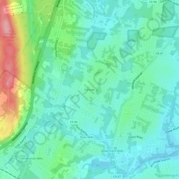
Name: Fardale topographic map, elevation, terrain.
Average elevation: 407 ft
Minimum elevation: 299 ft
Maximum elevation: 735 ft
Other topographic maps
Click on a map to view its topography, its elevation and its terrain.
Ramapo Valley County Reservation
United States > New Jersey > Bergen County > Mahwah
Average elevation: 584 ft
Ramapo Mountain State Forest
United States > New Jersey > Bergen County > Mahwah
Average elevation: 495 ft
Ramapo Valley County Reservation
United States > New Jersey > Bergen County > Mahwah
Average elevation: 584 ft