
Sliema topographic map
Interactive map
Click on the map to display elevation.
About this map
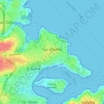
Name: Sliema topographic map, elevation, terrain.
Location: Sliema, Central Region, Malta (35.90528 14.49300 35.91890 14.51521)
Average elevation: 46 ft
Minimum elevation: 0 ft
Maximum elevation: 243 ft
Other topographic maps
Click on a map to view its topography, its elevation and its terrain.
Fleur-de-Lys
Malta > Central Region > Birkirkara
Fleur-de-Lys, Birkirkara, Central Region, BKR 9077, Malta
Average elevation: 154 ft