Geolocate

Galiano topographic map

Click on the map to display elevation.

About this map

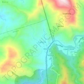
Name: Galiano topographic map, elevation, terrain.

Location: Galiano, La Union, Ilocos Region, Philippines (16.41691 120.44758 16.45691 120.48758)

Average elevation: 1,037 ft

Minimum elevation: 410 ft

Maximum elevation: 2,303 ft

Gear up for your next adventure:

💧Water Purification System - Clean water on the trail with reliable purifiers
📱Solar Portable Charger - Solar power bank for charging devices off‑grid
🧢Sun Protection Hats - Wide-brimmed and UPF-rated hats for high-altitude sun safety
🪑Portable Camp Table - Compact table for campsite meals
🏔️Mountain Trail Maps - High‑detail maps for popular peaks

As an Amazon Associate, this site earns from qualifying purchases at no extra cost to you.