
Thank you for supporting this site ❤️
Make a donation
Make a donation
Gear up for your next adventure:
As an Amazon Associate, this site earns from qualifying purchases at no extra cost to you.
Angualasto topographic map
Click on the map to display elevation.
Thank you for supporting this site ❤️
Make a donation
Make a donation
Gear up for your next adventure:
As an Amazon Associate, this site earns from qualifying purchases at no extra cost to you.
About this map
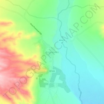
Name: Angualasto topographic map, elevation, terrain.
Location: Angualasto, Iglesia, San Juan, Argentina (-30.07532 -69.19421 -30.03532 -69.15421)
Average elevation: 5,518 ft
Minimum elevation: 5,279 ft
Maximum elevation: 5,951 ft
Thank you for supporting this site ❤️
Make a donation
Make a donation
Gear up for your next adventure:
As an Amazon Associate, this site earns from qualifying purchases at no extra cost to you.