
Thank you for supporting this site ❤️
Make a donation
Make a donation
Gear up for your next adventure:
As an Amazon Associate, this site earns from qualifying purchases at no extra cost to you.
Arerti topographic map
Click on the map to display elevation.
Thank you for supporting this site ❤️
Make a donation
Make a donation
Gear up for your next adventure:
As an Amazon Associate, this site earns from qualifying purchases at no extra cost to you.
About this map
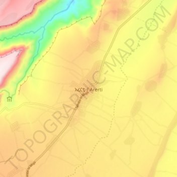
Name: Arerti topographic map, elevation, terrain.
Location: Arerti, North Shewa (K3), Amhara Region, Ethiopia (8.88853 39.38516 8.96853 39.46516)
Average elevation: 5,787 ft
Minimum elevation: 4,787 ft
Maximum elevation: 6,617 ft
Thank you for supporting this site ❤️
Make a donation
Make a donation
Gear up for your next adventure:
As an Amazon Associate, this site earns from qualifying purchases at no extra cost to you.