Geolocate

Gemas topographic map

Click on the map to display elevation.

About this map

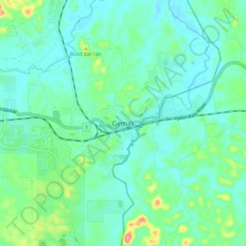
Name: Gemas topographic map, elevation, terrain.

Location: Gemas, Tampin, Negeri Sembilan, Malaysia (2.54130 102.57175 2.62130 102.65175)

Average elevation: 138 ft

Minimum elevation: 56 ft

Maximum elevation: 440 ft

Gear up for your next adventure:

🧯Portable Fire Pit - Compact fire pit for camping spots
🎒Gear Packing Cubes - Organize your backpack efficiently
🏥Hiking First Aid Kits - Comprehensive medical kits for remote trail injuries
👖Convertible Hiking Pants - Versatile zip-off pants for changing altitudes and temperatures
🦶Carbon Trekking Poles - Reduce knee impact on steep descents with ultra-light poles

As an Amazon Associate, this site earns from qualifying purchases at no extra cost to you.