Geolocate

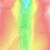
Les Pellys topographic map

Click on the map to display elevation.

About this map

Name: Les Pellys topographic map, elevation, terrain.

Location: Les Pellys, Sixt-Fer-à-Cheval, Bonneville, Haute-Savoie, Auvergne-Rhône-Alpes, France métropolitaine, 74740, France (46.05231 6.80644 46.09231 6.84644)

Average elevation: 4,570 ft

Minimum elevation: 2,707 ft

Maximum elevation: 7,533 ft

Other topographic maps

Click on a map to view its topography, its elevation and its terrain.
Gear up for your next adventure:

🎁Geography Themed Gifts - Unique gift ideas for map lovers and geography enthusiasts
🔥Plasma Lighters - Windproof lighters that work in any weather condition
🥾Men's Hiking Boots - Durable, waterproof footwear for rugged terrain and steep inclines
🛡️Bear Spray Outdoor - Protection in bear country hikes
🔌Solar Panel Charger - Charge gear sustainably outdoors

As an Amazon Associate, this site earns from qualifying purchases at no extra cost to you.