
Joplin topographic map
Click on the map to display elevation.
About this map
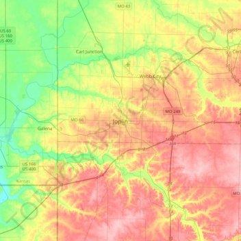
Name: Joplin topographic map, elevation, terrain.
Location: Joplin, Jasper County, Missouri, 64801, United States (36.92418 -94.67323 37.24418 -94.35323)
Average elevation: 984 ft
Minimum elevation: 774 ft
Maximum elevation: 1,198 ft
Jasper County trails, hiking, mountain biking, running and outdoor activities