
Nalchik topographic map
Interactive map
Click on the map to display elevation.
Nalchik
Nalchik (Russian: Нальчик IPA: [ˈnalʲtɕɪk]; Kabardian: НалщӀэч, Nalṣ̂ăčʼ [naːɮɕʼakʲ]; Karachay-Balkar: Нальчик [naltʃɯk]) is the capital city of Kabardino-Balkaria, Russia, situated at an altitude of 550 meters (1,800 ft) in the foothills of the Caucasus Mountains; about 100 kilometers (62 mi) northwest of Beslan (Beslan is in the Republic of North Ossetia–Alania). It covers an area of 131 square kilometers (51 sq mi). Population: 247,054 (2021 Census); 240,203 (2010 Census); 274,974 (2002 Census); 234,547 (1989 Soviet census).
About this map
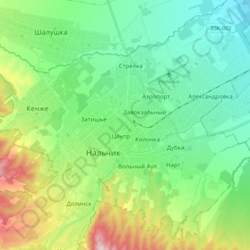
Name: Nalchik topographic map, elevation, terrain.
Average elevation: 1,732 ft
Minimum elevation: 1,243 ft
Maximum elevation: 2,861 ft