Geolocate

Diamond Head topographic map

Click on the map to display elevation.

About this map

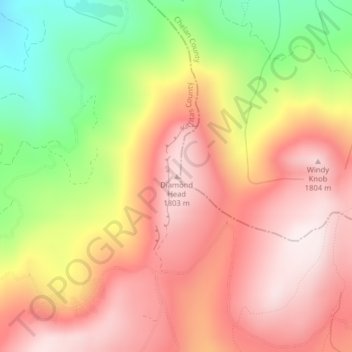
Name: Diamond Head topographic map, elevation, terrain.

Location: Diamond Head, Kittitas County, Washington, United States (47.31145 -120.57108 47.31155 -120.57098)

Average elevation: 5,154 ft

Minimum elevation: 3,993 ft

Maximum elevation: 5,965 ft

Kittitas County trails, hiking, mountain biking, running and outdoor activities

Other topographic maps

Click on a map to view its topography, its elevation and its terrain.

Rachel Lake

United States > Washington > Kittitas County

Average elevation: 4,610 ft

The Ganges

United States > Washington > Kittitas County > Ellensburg

Average elevation: 1,601 ft

South Cle Elum

United States > Washington > Kittitas County

Average elevation: 1,978 ft

Gear up for your next adventure:

🧺Microfiber Travel Towels - Compact and fast-drying towels for trail use
🔪Outdoor Multitools - Essential survival tools for gear repair and field use
🛠️Backpacking Tool Kit - Essential toolkit for outdoor repairs
🧥Men's Rain Shells - Premium waterproof and breathable jackets for mountain weather
🎒Hydration Pack - Hands‑free water reservoir for long hikes

As an Amazon Associate, this site earns from qualifying purchases at no extra cost to you.