
Thank you for supporting this site ❤️
Make a donation
Make a donation
Gear up for your next adventure:
As an Amazon Associate, this site earns from qualifying purchases at no extra cost to you.
Chenarlier topographic map
Click on the map to display elevation.
Thank you for supporting this site ❤️
Make a donation
Make a donation
Gear up for your next adventure:
As an Amazon Associate, this site earns from qualifying purchases at no extra cost to you.
About this map
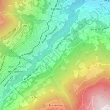
Name: Chenarlier topographic map, elevation, terrain.
Location: Chenarlier, Troistorrents, Monthey, Valais, Suisse (46.22599 6.92092 46.23667 6.93653)
Average elevation: 3,038 ft
Minimum elevation: 1,686 ft
Maximum elevation: 5,262 ft
Thank you for supporting this site ❤️
Make a donation
Make a donation
Gear up for your next adventure:
As an Amazon Associate, this site earns from qualifying purchases at no extra cost to you.